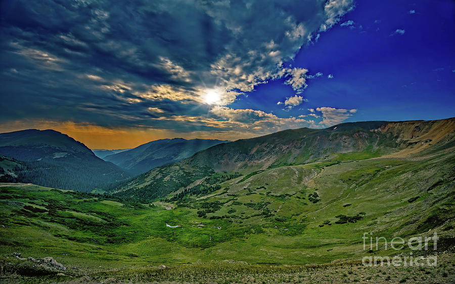
Rocky Mountain High On Trail Ridge Road

by Jon Burch Photography
Title
Rocky Mountain High On Trail Ridge Road
Artist
Jon Burch Photography
Medium
Photograph - Digital Photography
Description
Rocky Mountain National Park in north Colorado. The snowfields that remain in the cirque represent all that is left of the glacier that once carved this bowl shaped depression during the last ice age. If you look closely, there is usually a herd of elk somewhere in the bottom of the cirque.
Trail Ridge Road refers to a stretch of U.S. Highway 34 that traverses Rocky Mountain National Park from Estes Park, Colorado in the east to Grand Lake in the west. The road is also known as the Trail Ridge Road/Beaver Meadows National Scenic Byway.
Trail Ridge Road is usually closed during the winter, and often remains closed until late spring or early summer depending on the snow pack. It is the highest paved road in Colorado and it is also the highest paved road that crosses the continental divide. Cottonwood Pass at 12,126 feet is the second highest, and Colorado State Highway 82 at 12,095 feet going through Independence Pass is the third highest, but Trail Ridge Road takes first place!
Some digital effects were applied to the original image after the photograph was made. No electrons were harmed during the transition.
Image copyright 2021 Jon Burch Photography.
Uploaded
October 10th, 2021
Statistics
Viewed 398 Times - Last Visitor from New York, NY on 04/18/2024 at 11:52 AM
Embed
Share
Sales Sheet


