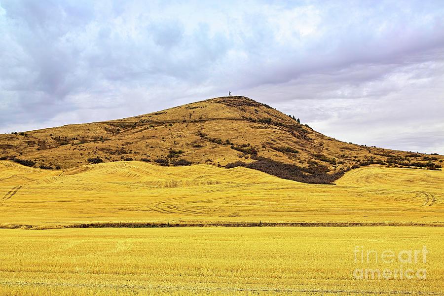
Steptoe Butte

by Jon Burch Photography
Title
Steptoe Butte
Artist
Jon Burch Photography
Medium
Photograph - Digital Capture/faa Watermark Will Not Be On Your Finished Photograph.
Description
Steptoe Butte in the state of Washington, was first called Pyramid Peak but later named "Steptoe" for a commander in the Indian Wars during an 1858 battle near the present town of Roselia, Washington. In the 1880's James S. Davis built a resort and observatory on top of the Butte's top incorporating a powerful telescope on the roof. He was called Cashup Davis as he bought only with cash. The town of Cashup was later named for him. After Davis's death, a local hotel was lost by fire. In 1846, Virgil T. McCrowkey donated his land to form Steptoe State Park. A road winds to the summet where visitors can enjoy a panoramic view of the Palouse Country. From the top of the butte, the eye can see 200 miles.
Steptoe Battlefield State Park is a 4-acre Washington state park in Rosalia, in Whitman County. The park preserves the site of a running battle also known as the Battle of Pine Creek, between American soldiers under the command of Lt. Col. Edward Steptoe and a large band of Spokane, Palouse, and Coeur d'Alene Native Americans.
A Steptoe, also called Dagala, a hill or mountain that projects like an island above a surrounding lava field. This type of land form is named after Steptoe Butte, a quartzite protrusion above the Columbia Plateau lava flows near Colfax, Washington.
The Palouse is a region of the northwestern United States, encompassing parts of southeastern Washington, north central Idaho and, in some definitions, extending south into northeast Oregon. It is a major agricultural area, primarily producing wheat and legumes. Situated about 160 miles north of the Oregon Trail, the region experienced rapid growth in the late 19th century, and at one time, the population of the Palouse surpassed even that of the Puget Sound area as the most populous region of the state. The region is home to two land grant universities, the University of Idaho in Moscow and Washington State University in Pullman.
The origin of the name "Palouse" is unclear. One theory is that the name of the Palus tribe was converted by French-Canadian fur traders to the more familiar French word pelouse, meaning "land with short and thick grass" or "lawn." Over time, the spelling changed to Palouse. Another theory is that the name was in the first place a French word, describing the area which was then applied to the indigenous people inhabiting it.
Traditionally, the Palouse region was defined as the fertile hills and prairies north of the Snake River, which separated it from Walla Walla County, and north of the Clearwater River, which separated it from the Camas Prairie, extending north along the Washington and Idaho border, south of Spokane, centered on the Palouse River. This region underwent a settlement and wheat-growing boom during the 1880s, part of a larger process of growing wheat in southeast Washington, originally pioneered in the Walla Walla County south of the Snake River. -- Wikki & others
Image copyright 2016 Jon Burch Photography all rights reserved.
Uploaded
October 20th, 2015
Statistics
Viewed 523 Times - Last Visitor from New York, NY on 04/15/2024 at 6:44 PM
Embed
Share
Sales Sheet


