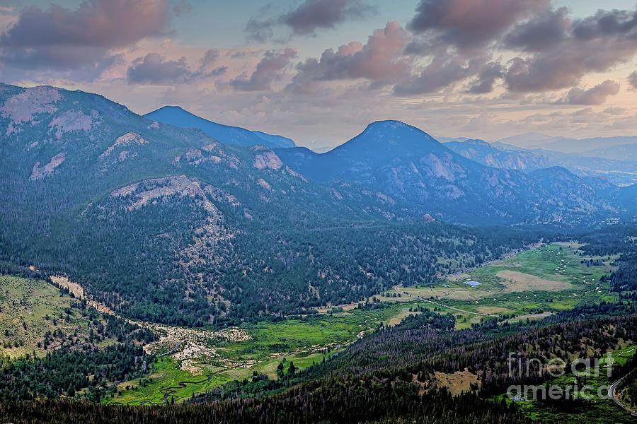
Fall River in Horseshoe Park

by Jon Burch Photography
Title
Fall River in Horseshoe Park
Artist
Jon Burch Photography
Medium
Photograph - Digital Capture/the Faa Watermark Will Not Appear On Your Final Photograph.
Description
Fall River and Sheep Lakes in Horseshoe Park, northern Colorado.
A 500-foot thick glacier once covered Horseshoe Park in Colorado's Rocky Mountain National Park. As the valley glacier inched along over hundreds of years, it scoured out the distinctive U-shaped valley that you are looking at. Like giant slow-motion conveyor belts, the glacial ice eventually carried it rock debris down the valley. At the farthest point of the glacier's advance it deposited a load of rock fragments, called a terminal moraine. About 15,000 years ago, the glacier began to recede.
As it dissipated, the glacier dropped rubble along its flanks, forming lateral moraines, and the melt water also left behind sediments that became these meadows in Horseshoe Park. Huge ice chunks split from the glacier and were buried in gravel as the glacier melted. These massive blocks created depressions which became the kettle ponds known as Sheep Lakes.
Fall River is a tributary of the Big Thompson River in Rocky Mountain National Park. The river's source is near the Alpine Visitor Center at the top of Trail Ridge Road. It flows down a canyon and over Chasm Falls before merging with the Big Thompson River in Estes Park.
Some digital effects were applied to the original image after the photograph was made. No electrons were harmed during the transition. Ordered images will not contain the FAA watermark.
Image copyright 2016 Jon Burch Photography all rights reserved.
Uploaded
May 2nd, 2016
Statistics
Viewed 175 Times - Last Visitor from Beverly Hills, CA on 04/23/2024 at 2:41 PM
Embed
Share
Sales Sheet


